


Central Florida Faces Weekend Deluge as Cold Front Arrives
URGENT WEATHER ALERT: A significant cold front is sweeping into Central Florida today, bringing widespread rain and cooler temperatures. Residents in Orlando, Daytona Beach, Lakeland, and Ocala should prepare for a wet and windy weekend.
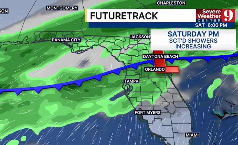
Starting on Saturday, December 7, expect mostly cloudy skies with isolated to scattered showers and thunderstorms developing in the afternoon and continuing into the evening. While most areas will experience light rainfall, residents should be alert for the possibility of quick downpours. Winds are anticipated to gust up to 20 mph with highs near 80°F.
However, Sunday, December 8, is predicted to be the wettest day of the weekend. Rain chances will significantly increase, with scattered showers and thunderstorms beginning late in the morning. The rainfall will become more widespread through the afternoon and evening, with some areas experiencing brief heavy downpours. Rainfall totals could reach up to 1/2 inch in a short time, particularly as the steadiest rain arrives on Sunday evening. Fortunately, no severe weather is expected, with highs dropping to the mid-to-upper 70s.
As the system moves out, Central Florida will dry out and cool down by early Monday morning, December 9. The upcoming week looks mostly dry and pleasant, with highs in the low to mid-70s through Friday.
Summary for Central Florida:
– Friday & Saturday: Near 80°F with increasing clouds
– Sunday: Highs 75–78°F, best rain chance (especially in the evening)
– Monday–Friday: Cooler and mostly dry, highs 72–76°F
Stay weather-aware this weekend if you have outdoor plans in Orlando, Daytona, or anywhere in Central Florida! Click here to download our free news, weather, and smart TV apps. Don’t miss out—click here to stream Channel 9 Eyewitness News live for the latest updates.