

US Military Halts Climate Data Sharing, Impacting Sea-Ice Research
In a move that has sent ripples through the scientific community, the U.S. Department of Defense has announced it will cease providing satellite data crucial for monitoring sea ice, a critical indicator of climate change. The decision, revealed on June 24, affects data processed by the Fleet Numerical Meteorology and Oceanography Center and has prompted an outcry from climate scientists who rely on this information for research.
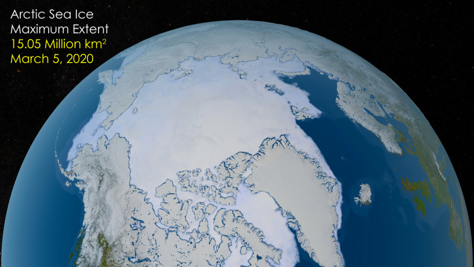
This development represents the latest in a series of actions by the U.S. government that critics argue undermine scientific research to facilitate budget cuts. Previously, agencies like the Goddard Institute for Space Studies and the National Science Foundation have faced budgetary constraints and operational disruptions. Now, the National Snow and Ice Data Center (NSIDC) at the University of Colorado Boulder faces a significant setback as it loses access to data from the Special Sensor Microwave Imager/Sounder (SSMIS), a tool vital for tracking sea ice coverage.
Impact on Climate Research
The SSMIS, part of the United States Air Force Defense Meteorological Satellite Program, has been an essential resource for scientists studying the effects of global warming. By measuring ice coverage on land and sea, the data provides insights into the health of polar ice caps, which act as buffers against glacier melting. Without this data, researchers fear they will be unable to accurately assess how close we are to significant climate tipping points.
“The sea-ice index is a sensitive barometer of climate change, and losing access to this data blinds us to one of the most significant measures of climate change,” said a spokesperson from the NSIDC.
The absence of this data also impacts commercial interests. With fewer icebergs, shipping routes around the North Pole can be shortened, leading to faster and more efficient maritime travel.
Global Alternatives and Challenges
While the U.S. decision marks a significant setback, other countries continue to operate similar satellite instruments. The Japanese Aerospace Exploration Agency (JAXA), for instance, operates the Global Change Observation Mission-Water (GCOM-W) satellite, equipped with the Advanced Microwave Scanning Radiometer 2 (AMSRS-2). This instrument can perform similar functions to the SSMIS.
Researchers at NSIDC have already begun transitioning to AMSRS-2 data. However, this switch requires time for calibration and integration with existing systems, resulting in a temporary gap in data collection that could hinder climate monitoring efforts.
Political and Scientific Ramifications
This decision comes amid broader political debates over climate science and government funding priorities. Critics argue that such moves jeopardize the U.S.’s leadership in climate research and could have long-term consequences for global climate policy.
“From a scientific perspective, this is madness. We are losing a critical tool for understanding our planet’s climate system,” noted a climate expert familiar with the situation.
The implications of this data gap are profound. Without accurate and timely information, policymakers and scientists may struggle to develop effective strategies to combat climate change and mitigate its impacts.
Looking Ahead
As the scientific community adapts to these changes, there is a growing call for increased international collaboration and investment in alternative data sources. The transition to AMSRS-2 and other global resources highlights the need for resilience and adaptability in climate research.
The coming months will be critical as scientists work to bridge the data gap and continue their vital research into the planet’s changing climate. The decision by the U.S. Department of Defense underscores the complex interplay between politics, science, and global environmental challenges.