Researchers Decode Lightning’s Radio Frequencies to Predict Severe Weather

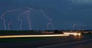
Scientists at Los Alamos National Laboratory (LANL) have made significant strides in understanding the radio frequencies produced by lightning in clouds. Their research focuses on the phenomena of in-cloud lightning, particularly a type known as compact intracloud discharges. Through extensive data collection, researchers aim to enhance prediction methods and preparedness for increasingly severe weather events.
Over a period of two months, from January to June 2023, the LANL team, led by researchers Erin Lay and Amitabh Nag, compiled the largest database of trans-ionospheric pulse pairs, which are high-frequency radio signals generated by lightning. Utilizing a satellite sensor located approximately 22,000 miles above Earth, they captured over 76,000 pulse pair signatures and verified these findings with ground-based lightning reports.
Understanding Intracloud Lightning
The radio signals analyzed are associated with compact intracloud discharges, which are characterized by rapid bursts of lightning occurring within clouds. These discharges produce electromagnetic pulses that travel both upwards and downwards, reflecting off the Earth’s surface. Surprisingly, the intensity of each pulse can vary significantly.
“It has long been a question why sometimes the second amplitude is stronger than the first,” Lay explained. By organizing the data according to altitude, the researchers uncovered a correlation between the lightning’s location within the cloud and the relative strengths of the two pulses. “Whether the first or second pulse was stronger depended on where the lightning occurred in the cloud,” Lay added.
The structure of thunderclouds is essential to this research. Typically, they consist of three main layers: two positively charged layers sandwiching a negatively charged layer. Occasionally, an additional negatively charged layer, known as the “screening charge” layer, can form at the cloud’s upper region. This upper area is crucial for understanding the dynamics of intracloud lightning.
Implications for Severe Weather Understanding
While compact intracloud discharges are relatively rare, their unique characteristics and brightness make them significant in meteorological studies. “This type of lightning is a small fraction of overall lightning activity, but it plays a critical role in illuminating the Earth’s atmosphere and transmitting energy into space,” Nag stated.
The research team aims to collect more data to isolate additional variables that will deepen their understanding of lightning’s behavior. Lay emphasized the importance of this work, noting its relevance to the evolution of severe weather. “Understanding these phenomena helps us better comprehend how severe weather impacts our infrastructure and safety,” she said.
As the study of in-cloud lightning continues, Lay and Nag’s work at LANL seeks not only to advance scientific knowledge but also to inform strategies for protecting communities and ecosystems from the effects of severe weather. Through their ongoing research, they hope to answer fundamental questions about lightning and its relationship to atmospheric conditions, ultimately contributing to enhanced safety measures for human and animal populations alike.


