
Hurricane Kiko Strengthens to Category 2, Major Impact Expected
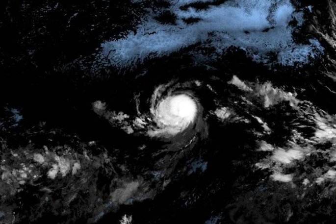
Tropical Storm Kiko has intensified into a Category 2 hurricane as of September 3, 2023. According to the National Hurricane Center (NHC), the storm now boasts maximum sustained winds of 105 mph. It is currently situated approximately 1,740 miles east of Hilo, Hawaii, and is progressing westward at a pace of 7 mph. Forecasters predict that Kiko could evolve into a major hurricane within the next few days.
Storm’s Path and Forecast
The NHC indicates that a subtropical ridge located north of Kiko is steering its course. The agency expects Kiko to maintain a slow westward trajectory for the next two days, with a potential shift toward the west-northwest in three to four days. At present, there are no weather watches or warnings in effect, as the hurricane is anticipated to remain over open waters in the eastern Pacific Ocean.
Meteorologists note that while Kiko is projected to enter drier air and cooler waters in the coming days, it is expected to gain strength until these conditions take effect. The storm is anticipated to maintain hurricane status for at least five days.
Historical Context
Kiko formed on Sunday, marking it as the 11th named storm in the Eastern North Pacific this year. As it develops, Kiko serves as a reminder of the ongoing hurricane season and its potential impacts on surrounding regions.
Residents and authorities are urged to stay updated on the storm’s progress, as changes in its path or intensity could influence weather conditions in the Pacific region. The NHC will continue to provide updates as Kiko evolves, ensuring that communities are informed and prepared for any developments.